Close to 3 million homes in the U.S. are facing a distinct threat from wildfires—and more than two-thirds of those properties are clustered in just three states.
The at-risk dwellings, scattered across 14 states in the Western and Southern regions of the country, carry a staggering combined reconstruction cost value (RCV) of $1.3 trillion, according to a new report, “Wildfire Risk 2025: Priced Out and Burned Out,” from Cotality, a property data analytics firm.
Of the homes threatened by wildfires, 1.2 million face a “very high risk,” while 800,000 face high risk, and 500,000 face moderate risk.
Notably, nearly half of all the vulnerable homes are in California, at just under 1.3 million. If destroyed by wildfire, it will take $796.1 billion to rebuild the lost dwellings, according to Cotality’s analysis.
Colorado is second on the list of states with the greatest number of homes at moderate or greater wildfire risk, at 318,783 properties with a total RCV of $146.2 billion.
Rounding out the top three is Texas, where 243,136 homes face elevated fire risk, to the tune of $95.4 billion in reconstruction costs.
Oregon is the nation’s fourth most wildfire-exposed state, with roughly 128,000 properties facing potential disaster and $47.5 billion in rebuilding costs, followed by Arizona, with nearly 124,000 vulnerable homes and $39.2 billion in combined RCV.
The common denominator among the five most fire-susceptible states is that they all have a large number of homes in what is known as the Wildland-Urban Interface (WUI), where residential developments sit next to forested or underdeveloped tracts of land, raising their risk levels.
“There are many contributing factors to the increasing threat of wildfires, including where and how we build,” stated Tom Larsen, assistant vice president of product marketing for insurance solutions at Cotality.
“Building with wildfires in mind and introducing mitigation measures for where we have already built is one of the critical conversations we need to be having right now.”
Some of the other factors contributing to increased wildfire risks, according to the report, include decades of fire suppression that have left forests densely packed with combustible materials, population growth in WUI zones, and hotter, drier seasons turning vegetation into kindling ready to burst into flames.
The Golden State’s wildfire woes
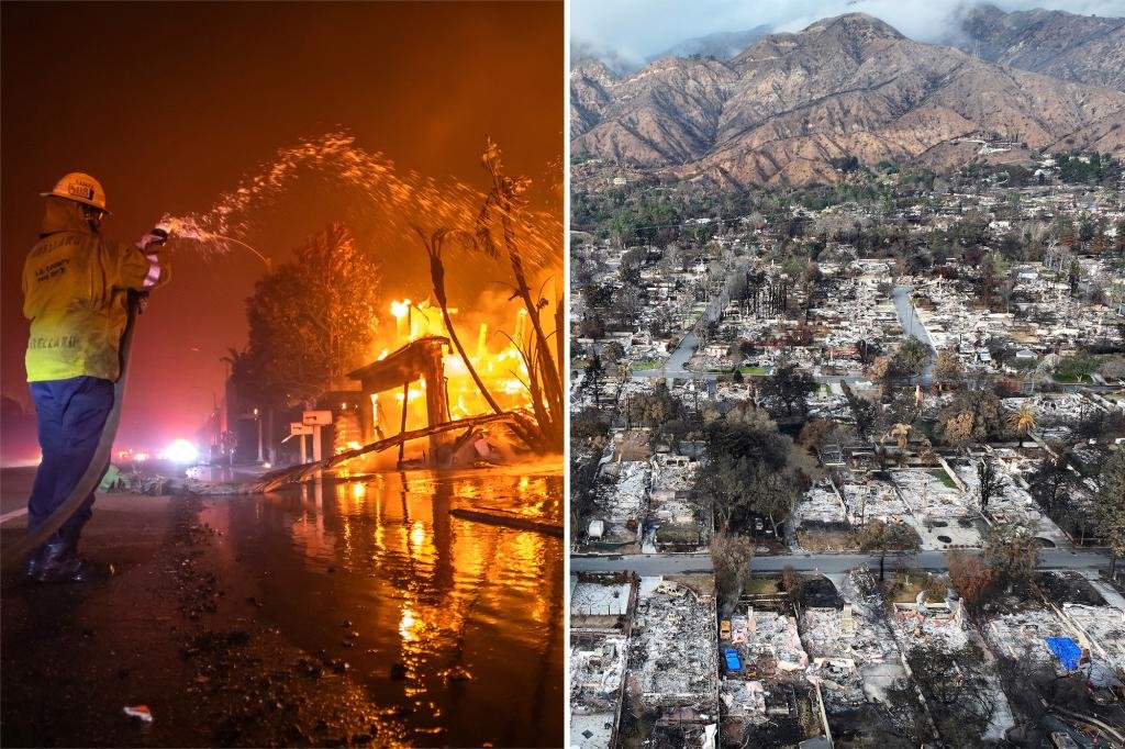
California is in the unenviable position of having the most homes facing moderate to greater risk of wildfire—a fact that should come as no surprise after January’s catastrophic Palisades and Eaton fires, which scorched through Los Angeles and its surrounding areas.
The twin conflagrations killed at least 30 people, and damaged or destroyed more than 13,500 properties in the affluent enclave of Pacific Palisades and in Altadena, leaving in their wakes more than $40 billion in insured losses.
Months later, recovery and rebuilding efforts in Los Angeles and nearby towns are ongoing—and could well continue for many years to come.
But according to the Cotality report, California is not out of danger from wildfire threat, considering that it is home to eight of the top 15 metros with the most homes at moderate or greater wildfire risk, with Los Angeles still in the lead.
The nation’s second most populous city has roughly 241,000 homes that continue to face an elevated risk of wildfires, the most of any metro, followed by Riverside, CA, San Diego, and Sacramento.
The state’s other most at-risk cities include San Francisco, Oxnard, Redding, and Chico.
Together, the eight metros have a massive combined reconstruction cost value of more than $600 billion—or nearly half the total RCV for all 14 at-risk states.
Despite the elevated risks and colossal rebuilding costs, California’s housing markets are among the most expensive in the U.S., suggesting that buyers are willing to take a chance when it comes to owning property in a desirable area.
As of July, Los Angeles had the second-highest median list price in the U.S., at $1.148 million, followed by San Francisco, at $990,000, and San Diego, at $987,500, according to the latest monthly housing market trends report from Realtor.com®.
In fact, the latest research from Realtor.com shows that seven of the top 10 most expensive ZIP codes in the U.S. are in California, including the ultra-expensive communities of Bel-Air, Beverly Hills, and Malibu, all located not far from downtown L.A.
Not just a California problem
While California leads the nation in the number of homes exposed to heightened wildfire risk, metros across other Western states also have reason for concern.
Austin, TX, San Antonio, TX, Denver, Colorado Springs, CO, Bend, OR, Flagstaff, AZ, and Prescott, AZ, are among the 15 most at-risk metros.
For example, Austin, which occupies the No. 5 spot on the Cotality list, has more than 94,000 vulnerable properties with RCV of $44.1 billion, while San Antonio (No. 7) has nearly 79,000 dwellings that could fall victim to wildfires.
Meanwhile, the two Colorado metros on the list could be on the hook for more than $60 billion in reconstruction costs if wildfires destroy the cities’ endangered properties.

